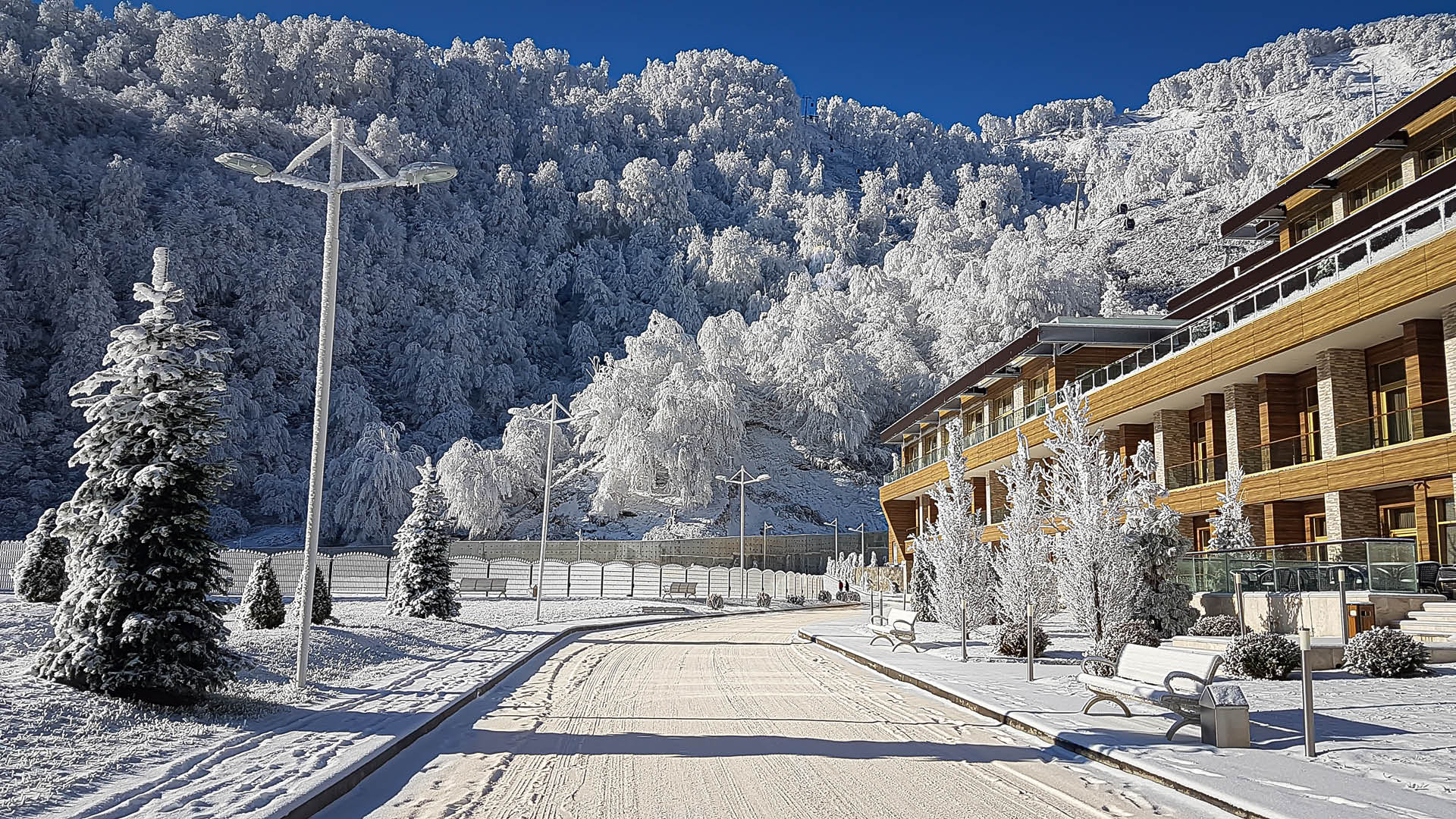
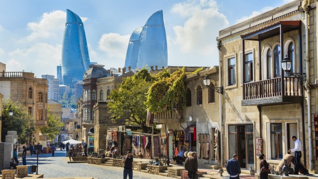
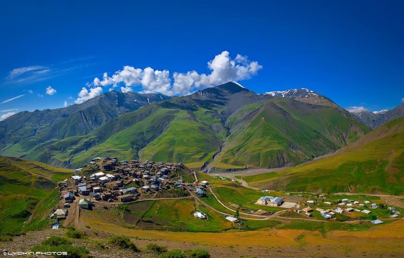
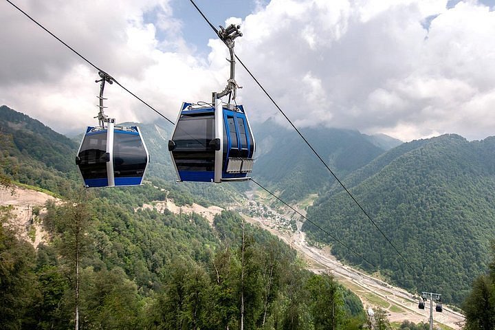
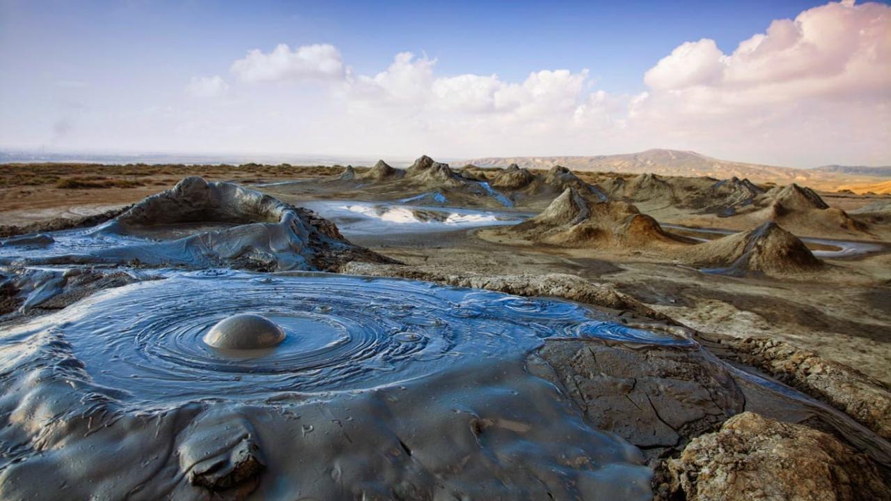
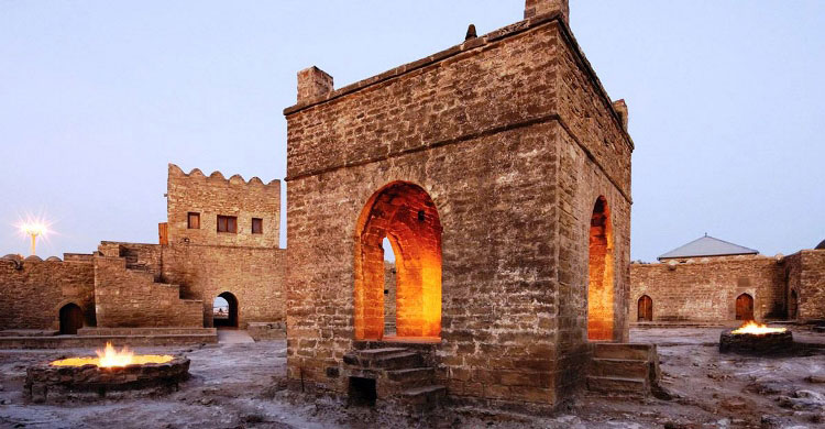
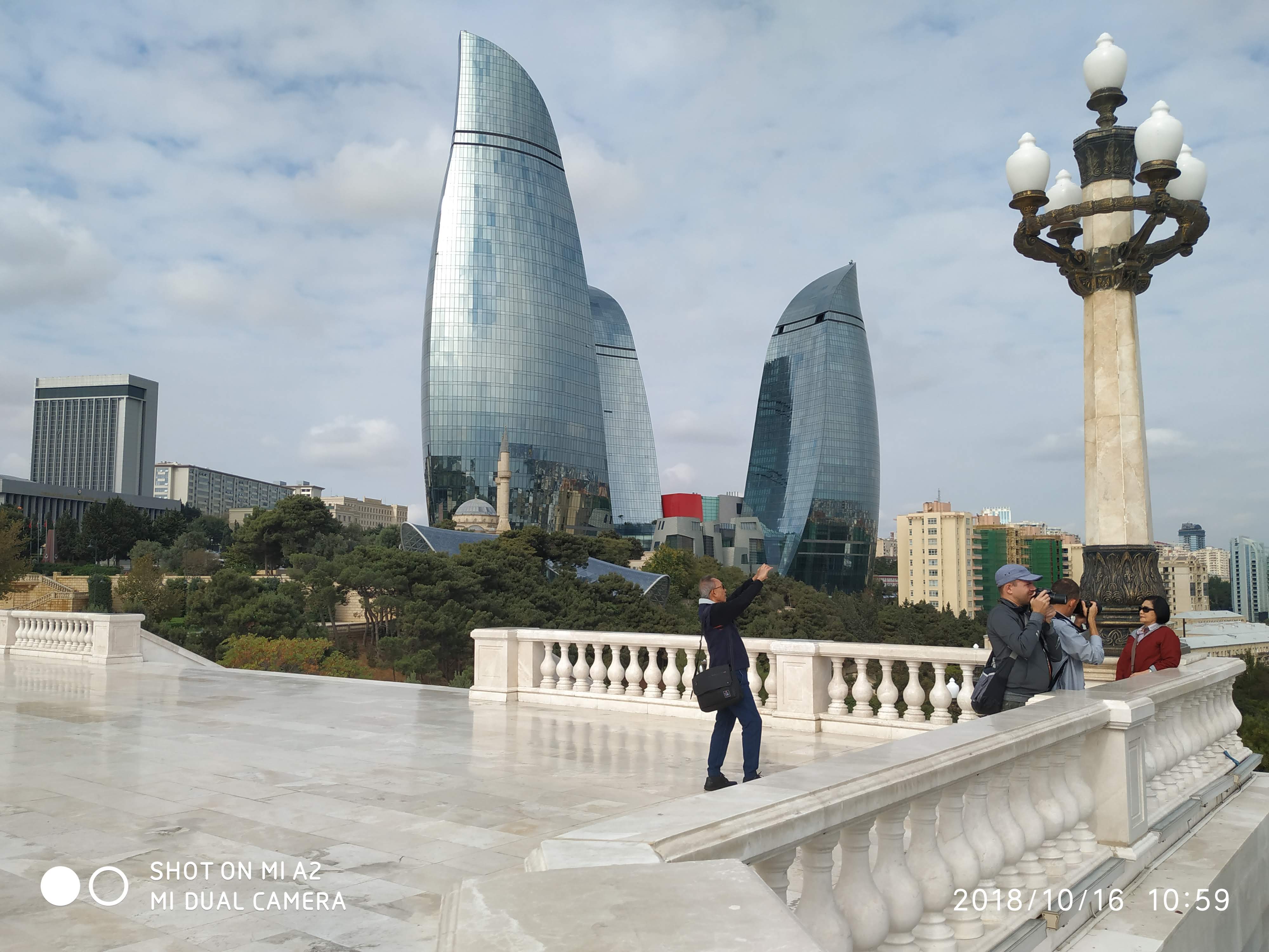
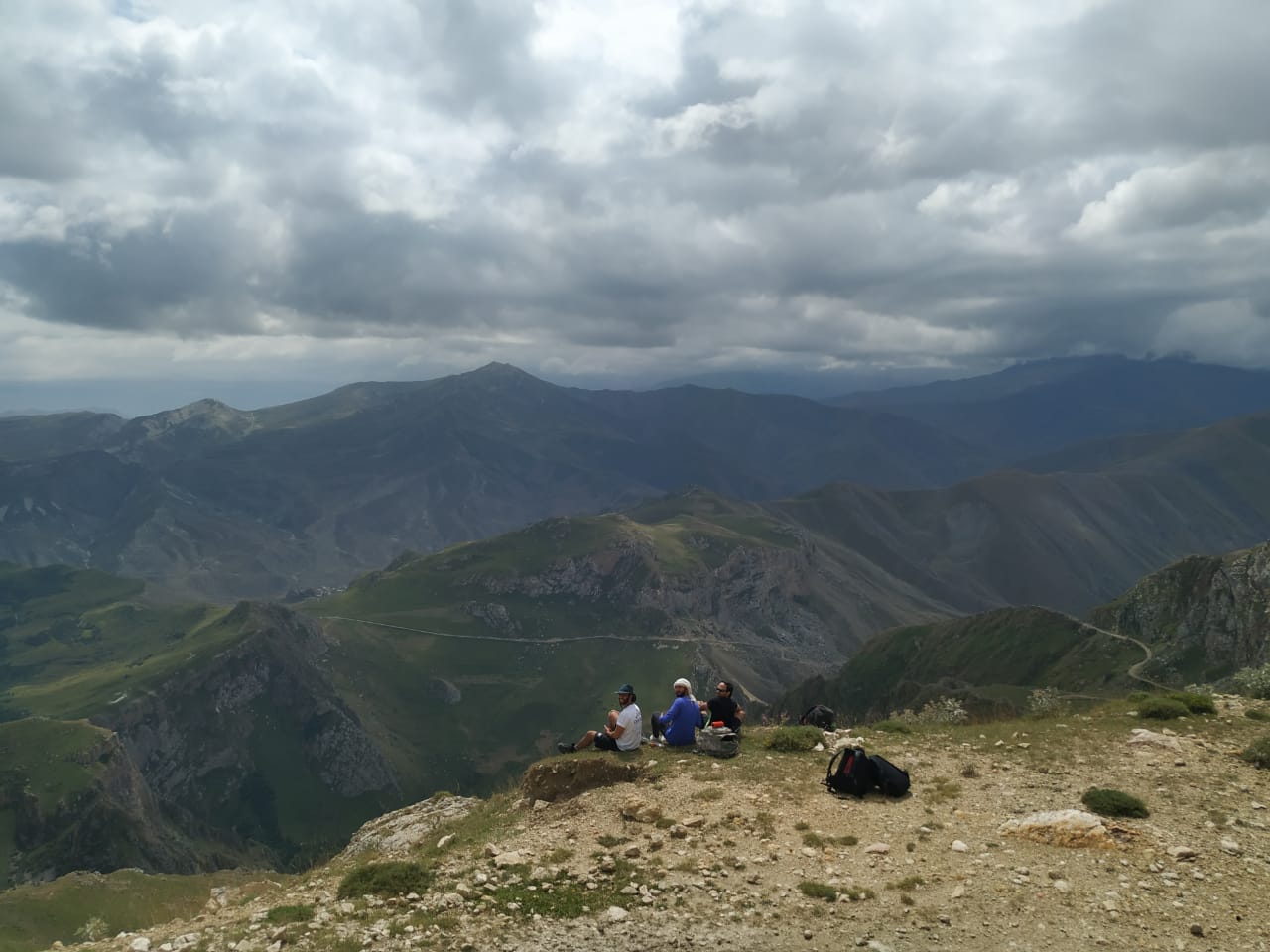
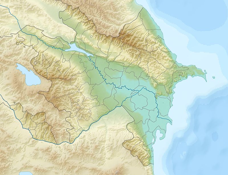
Nakhchivan AR
Kengerli
Territory: 681,94 km2
Population: 29,200
How to get to: By air: Baku – Nakhichevan
By road / regular
buses: Nakhichevan - Kengerli
This
youngest district in the body of Nakhichevan Autonomous Republic was
established in 2004. The Administrative center is settlement Givrag which is
located at Nakhichevan – Sharur highway, in 30 km from Nakhichevan city. There
is Araks river flowing at the distance of 6 km from the settlement.
In the north
the district borders Armenia and in the south Iran. The climate here is sharply
continental – there is very hot in summer and very cold in winter.
Its name
the district has received from the people kengerli.
Like in all
parts of Nakhichevan Autonomous Republic there are a lot of monuments in
Kengerli that justify the fact that people populated this area in ancient
times: barrows Chalkhan Gala, cave Gazma, settlements Galadjig, Govurgala,
Damlama, Gulamlitepe, Balatepe. The other preserved monuments of the later
period are: mosque Jame in Hok village (XVIII c.) and bath in Shakhtakhti
village (XIX c.).
At the
distance of 30 km to the south-east from the center of the district in the
picturesque place on the slope of Lesser Caucasus there is a Garabaglar village
(“many gardens”).
In this
village as well as everywhere in Nakhichevan traditions and ceremonies are
preserved very carefully. This will be very interesting for tourists to watch
the performance of the folklore group “Gulemey” – this is a women’s folklore
group of Garabaglar village. Gulemey – this is a game that is played only by
girls at the event in bride’s house. It’s called also “Dilalli”. The essence of
the game is the following: girls are singing quatrains at the end of which as a
refrain they repeat the word “Gulemey”.
It’s
interesting also to visit Shakhtakhti village located not far from Garabaglar.
The village was a property of the famous dynasty of Shakhtakhtinsky. Their
genealogy comes back to Chingiz-khan, the founder of their family was his grand
son Hullagu-khan. This village was inherited from generations to generations.
The clan of Shakhtakhtinskiy lived in Nakhichevan, Irevan and Tbilisi where
they owned houses and lands. Among representatives of this family there were
many scientists, cultural workers, artists and diplomats.
There is a
bath preserved (XIX c.) built by Isa Sultan Shakhtakhtinskiy. The bath is under
the ground by half. There are several reasons why it is located in the center
of the village. Like locals say it was a recreational place as well for
inhabitants of the village. Pehlevans had competitions here, different kinds of
show took place here as well.
The most
ancient and majestic fortress of Nakhichevan is located not far from
Djalkhangala village. A mountain path of 3 km leads there where you can rise
only on foot. This excursion takes one day. Djalkhangala is the most
picturesque mountain village located in dense forest. All these places of
interest are worth seeing them.
Due to the
fact that the district has recently received the status of administrative
center there is no infrastructure for welcoming the tourists in Givrag village.
But it’s always possible to stay in houses of local inhabitants.
Nakhchivan
Territory: 191,57 km2
Population: 86,400
By air: Baku - Nakhichevan
The capital
of Nakhchivan Autonomous Republic, Nakhchivan City is situated on the Nakhchivan
River Embankment, very close to the Iranian border, and 536 km away from Baku.
It is one of the most ancient cities of Azerbaijan and reliable sources indicate
that Nakhchivan City’s foundation was laid in around 1500 BC. However, a folk
legend says the city takes its beginning from Noah’s time, and Noah himself
laid a foundation of the city after the Flood. There is Noah’s Mausoleum
preserved in the southern part of the city. A temple once stood here, but
unfortunately, it was destroyed, and the Mausoleum that people can visit today
occupies the lower floor of the destroyed temple. There are names of pilgrims
who once visited this place engraved upon the walls of this unique monument.
Nakhchivan
had been admired and viewed by many travelers and poets of the past as one of
the most beautiful and prosperous cities in the East. And today the city, due
to its numerous monuments reflecting different stages of history, is an
attractive destination for tourists. The Mausoleum of Yusuf ibn Kuseyr (1162),
Alinja-Gala Fortress (11th-13th centuries), the majestic Khan Palace (18th
century) and other historical venues would give to visitors an unforgettable
experience.
However,
Nakhchivan’s main attraction for tourists today is, of course, the therapeutic
salt caves of Mount Duzdag located at a height of 1,173m above sea level.
Individuals suffering with respiratory disease find great results of treatment
procedures here. The clinic itself consists of two parts: above ground and
underground parts. The first one is placed in a very comfortable venue called
Duzdag Hotel, and the second part is in the mountain down to a depth of 300
meters. The clinic in Duzdag Hotel has five salt mines where rooms with beds, a
café, TV-salon, and the library are provided for patients use.
The clinic
patients may spend their free time visiting Aqua Park, indoor and outdoor
pools, basketball and soccer fields, tennis courts, and a fitness complex to
enjoy the services provided here.
Ordubad
Territory: 972,05 km2
Population: 10,300
By road and railway: Nakhichevan - Ordubad
The Ordubad city is the second by importance in Nakhichevan Autonomous Republic. It is located at the foothills of the Zangezur range, at the bank of Ordubadchay river, on the slopes of the canyon of the same name.
Ordubad is a small town – its population is slightly exceeding 10 thousands. It is known since XII century. Numerous local architectural monuments indicating its history were combined into historical-architectural reserve in 70ies.
But the most fame was brought to this town by rock paintings at the mountain Gemigaya located in 60 km to the south from Ordubad. This place is the second after Gobustan by concentration of petroglyphs in Azerbaijan. Thousands of them are telling about life of man 3-2 thousands years BС and about the world surrounding him. Thousands of tourists and scientists are visiting these places every year.
Ordubad has a wonderful nature, rich flora and fauna. Fresh clean air, unique medicinal herbs, flavoured fruits have brought glory to the district. Peaches, pears, grapes, apricots from Ordubad are very popular because of their juiciness and sweetness. Ordubad is famous by its gardens and long-lived planes, the biggest of them has a diameter of 18 meters. Silk from Ordubad won 13 gold medals at the international exhibitions at the beginning of 13 century. Silk plant works here at present as well. Definitely Ordubad is wonderful at any season. Plenty of historical monuments, interesting architecture and picturesque landscapes make it one of the most attractive places at the touristic map of Azerbaijan.
Sharur
Territory: 811,14 km2
Population: 107,400
By road and railroad: Nakhichevan - Sharur
Sharur is an administrative center of Sharur district of Nakhichevan Autonomous Republic of Azerbaijan. Formerly known as Norashen and then renamed after Lenin into IIyichevskiy this district is located in the west of NAR and has a border with Armenia and Iran. There is mountain chain Dereleyez at the territory of the district. Despite the fact the this city is young this land is an area of ancient settlements as a fact. The date of foundation is unknown. The name of Sharur is mentioned as a name of one of clans in “Kitabi Dede Gorgud”. Excavations made in Arpachay and Araz rivers’ valleys found tracks of settlements of the Bronze Age.
There is one detail (like avarywhere in Nakhichevan) that attracts your attention when you walk in Sharur. These are nests of storks constructed right on the electric poles. This is a tipical picture for this region. Whenever you travel in Nakhichevan you will be accompanied by these nests darting behind the window and giving the whole journey a specific atmosphere. As well as the whole territory of Nakhichevam Sharur is rich of historical monuments. A special place among the occupy fortresses located on the top of mountains “Giz galasi” and “Oglan galasi”.
Sharur is famous by its dance “yalla”. This ancient dance is one of the cultural heritages of Nakhichevan that is considered as its motherland.
By the way the real motherland of yalla is Cherchibogan village. The dance group “Nurani” consists of aksakals of this village. This is a group of men where the youngest is 61 years old and the oldest is 80.
There are two parks, a stadium, museum, mosque, monument-memorial of shekhids, cinema and two hotels in the city. An Olimpic complex was opened in Sharur in 2009. Here is an old city with some ancient mosques, baths preserves and a good market. In fact tourists will find the recreation in Sharur fascinating and informative.
Shahbuz
Territory: 1 thousand 005 hectares
Population: 23,600
By road: regular buses Nakhichevan - Shakhbuz
Shakhbuz district is located at the north of Nakhichevan Autonomous Republic. The administrative center of the district - Shakhbuz city. An ancient sites were found close to the Shakhbuz. Unusual residential places consisted of 4 rooms and one balcony were cut in the wall. Local inhabitants call this place “Farhad’s house”. This name is connected with the name of the hero of the poem of Nizami Gandjevi Farhad who in order to give water to his beloved cut rocky mountains and built a canal. In the other place archaeologist have found remains of powerful construction named after khan governed here some time ago “Shakhpur Gala”.
At the altitude of 1400 meters at the picturesque natural place is located a recreation area “Badamli”. Here is a plant for bottling of mineral water Badamli. The district has a deposits of minerals: sulphur, peat, construction materials. District is rich in mineral water – springs of Badamli, Bichanak, Batabat, Karvansaray and others. Climate is hot in summer and cold in winter. Through the district flows river Nakhchivanchay and its tributaries Salvarti, Kuku, Shakhbuz and others. There are also lakes Batabat, Ganligel and others. In forests one can find such trees like oak, beech and hornbeam. Fauna is presented by bear, Caucasian goat, lynx, wild boar, wolf, fox and others.
By the way very soon Shakhbuz will become a tourist center because Shakhbuz district of Nakhichevan Autonomous Respublic is awaiting for urbanization. The Committee on regional issues of Milly Medjlis has recommended by low to enlarge the territory of this district at the expense of neighboring villages – Ayrindj, Daylagli and Garababa that are going to join the city completely. The territory of the Shakhbuz city will be enlarged almost twice – up to 2,826,6 hectares. The final goal of these changes – development of the city and its tourist infrastructure first of all.