Start point: Griz village
End point: Gur-Gur waterfall
Start altitude: 2016 m
End altitude: 2280m
Ascent: 354m
Descent: 90m
Duration: 2 hours
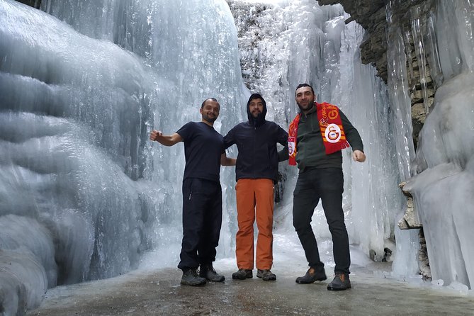
The village of Griz has located 30km from the centre of the Guba region and is at an altitude of 2016m above sea level. Griz village is on the slopes of the main Caucasian Range. There are currently 30-40 houses in the village of Griz. The population of the village is about 200 people. Griz village lies on the tall cliffs on the left bank of Gudjalchay. There is only one way to the village - this way is only possible with mountain cars. The highest bridge across the country is the path to this village. From the village of Griz to the Great Mountains of Caucasus (Khinalig, Babadagh, Mastdargah mountains and Gizilgaya range) opens a marvellous landscape. Griz village is one of the most snow-falling settlements in Azerbaijan. Gur-Gur waterfall is located 2km from the village of Griz. The water flowing from the rocks takes the waterfall froth and creates a small basin where it falls. In the winter, this waterfall is a cave forming ice.
The distance from the village of Gur-Gur to the waterfall is 2 km. After returning to the Gur-Gur waterfall, we return to Griz village again. It is one of the easiest routes in between hiking tours. It's an interesting, picturesque, and comfortable route for beginners.
Tour Program:
Including:
| Pax number | 1 | 2 | 3-6 | 7-10 | 11-13 | 13-15 |
|---|---|---|---|---|---|---|
| Price PP (USD) | 263 | 122 | 102 | 63 | 52 | 50 |