Griz village’s waterfalls hiking tour (Easy)
Budget
55 USD
Per Person
Tour start date
01.01.2021
Duration
2 Hours
Start point: Griz village
End point: Gur-Gur waterfall
Start altitude: 2016 m
End altitude: 2280m
Ascent: 354m
Descent: 90m
Duration: 2 hours
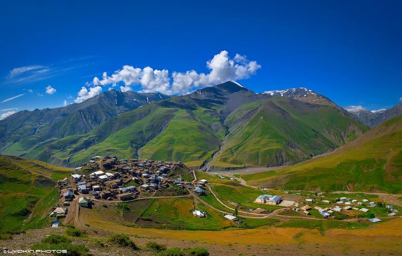
The village of Griz has located 30km from the centre of the Guba region and is at an altitude of 2016m above sea level. Griz village is on the slopes of the main Caucasian Range. There are currently 30-40 houses in the village of Griz. The population of the village is about 200 people. Griz village lies on the tall cliffs on the left bank of Gudjalchay. There is only one way to the village - this way is only possible with mountain cars. The highest bridge across the country is the path to this village. From the village of Griz to the Great Mountains of Caucasus (Khinalig, Babadagh, Mastdargah mountains and Gizilgaya range) opens a marvellous landscape. Griz village is one of the most snow-falling settlements in Azerbaijan. Gur-Gur waterfall is located 2km from the village of Griz. The water flowing from the rocks takes the waterfall froth and creates a small basin where it falls. In the winter, this waterfall is a cave forming ice.
The distance from the village of Gur-Gur to the waterfall is 2 km. After returning to the Gur-Gur waterfall, we return to Griz village again. It is one of the easiest routes in between hiking tours. It's an interesting, picturesque, and comfortable route for beginners.
Tour Program:
- Setting out from the hotel at 8:00 AM with an air-conditioned car
- Getting 4x4 cars from Griz bridge to drive offroad to the village
- Starting the hike from the village to the waterfalls
- Hiking back to the village
- Lunch at the local’s house
- Driving back to Baku. Reaching the hotel around 21:00
Including:
- Air-conditioned car
- 4x4 car
- Lunch
- Hiking guide
Price:
|
Pax number |
1 |
2 |
3-6 |
7-10 |
11-13 |
13-15 |
|
Price PP (USD) |
250 |
160 |
115 |
80 |
70 |
55 |
Book This Trip
ESSENTIAL TRIP INFORMATION
TRIP INCLUSIONS
Want an in-depth insight into this trip? Essential Trip Information provides a detailed itinerary, visa info, how to get to your hotel, what's included - pretty much everything you need to know about this adventure and more.
Accomodation
No
Meals
Lunch
Transport
Air-conditioned car, 4x4 car
SIMILAR TRIPS
You May Also Enjoy Our Other Trips
Cultural tours
Guba- Shahdag tour
Guba is located along the banks of the river Gudialchay 600 m above sea level. Famous for carpets and apple orchards.
$20 USD Per Person
Cultural tours
Gabala tour
The Gabala tour is one of the most popular and featured experiences that we provide. During this special full-day Gabala tour from Baku first stop will be Juma mosque in the Shamakhi region.
$20 USD Per Person
Cultural tours
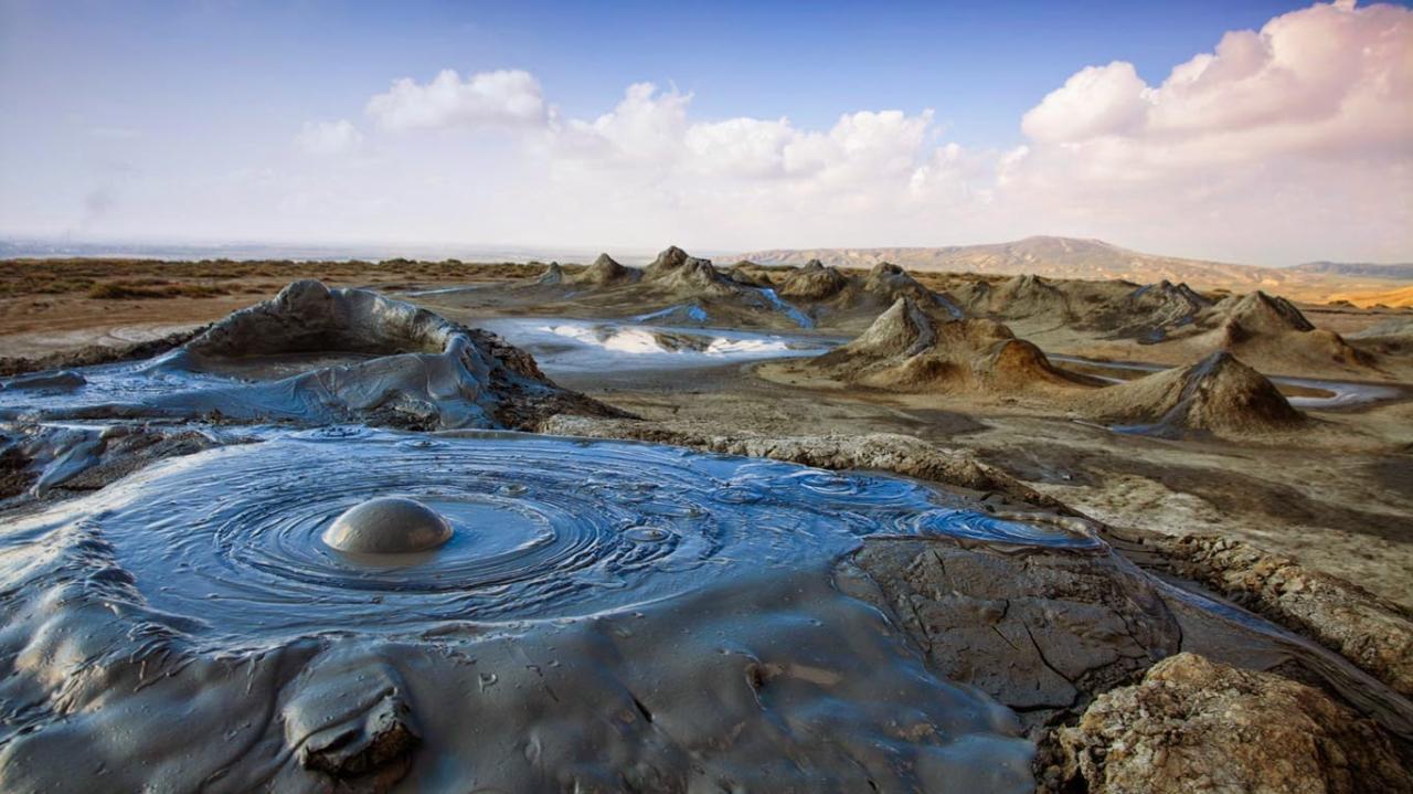
Gobustan & Mud Volcanoes tour
Gobustan National Park officially Gobustan Rock Art Cultural Landscape is a hill and mountain site occupying the southeast end of the Greater Caucasus mountain ridge. Mud volcanoes are some of the most unique natural phenomena on Earth. They are active, impressive and worth seeing.
$11 USD Per Person
Cultural tours
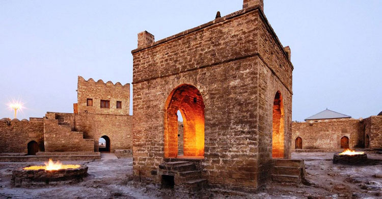
Absheron Tour - Ateshgah & Yanardag
Ateshgah Temple – The temple of fire worshippers Ateshgah is located at the Absheron peninsula at the outskirts of Surakhani village 30 km from the centre of Baku and was revered in different times by Zoroastrians, Hindus and Sikhs.
$11 USD Per Person
Cultural tours
Baku City tour
We will start our tour from Highland Park and the Alley of Martyrs. Highland Park is located on a hill in the western part of the city. This is the best place to see the city and Baku Bay. The architecture of the capital is very eclectic; it is a combination of different styles and influences such as Baroque, classicism, and modern architecture, both Eastern and Western.
$11 USD Per Person
Our Partners